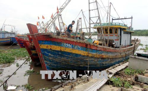
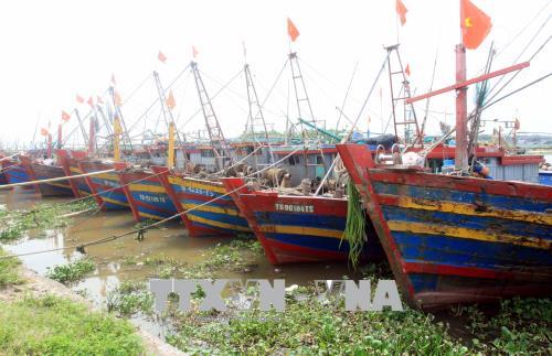
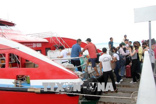
 Storm Mulan heads toward northern coast
Home > Policies
Flag tower and flagpole - safeguard of national border sovereignty
By VNA 12/18/2017 11:04 |
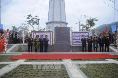
Flag tower and flagpole - safeguard of national border sovereignty (Photo VNA)
A new border tower, situated at the place where the Hong (Red) River) enters Vietnam from China, in A Mu Sung commune, Bat Xat district in the northern mountainous bordering province of Lao Cai, contributes to affirming the national border sovereignty.
The new national flag tower was inaugurated in A Mu Sung commune, Bat Xat district in the northern mountainous
The tower, situated at the place where the Hong (Red) River) enters
The project, worth over 17 billion VND (748,000 USD) sourced from donations, was started in March 2016.
The tower is 31.43 metres high and holds a 25-sq.m flag. The figures represent the 3,143-metre high Fansipan peak and 25 ethnic groups in the province.
The work demonstrates the will and determination of local youths to build on the tradition in building and protecting the nation, while contributing to affirming the national border sovereignty and developing local tourism.
The tower was handed over to the People’s Committee of Bat Xat district for management.
The Lung Po flag tower is expected to be one of the new tourism destinations in the locality’s tour through Lao Cai – Bat Xat – Sapa.-VNA
In July this year, a 38.8m-high flagpole was inaugurated in Con Co island district, the central
With a flag measuring 24sq.m, the pole is bigger than others built on Vietnamese islands. As a symbol of independence, freedom and peace, the flagpole affirms the national sovereignty.
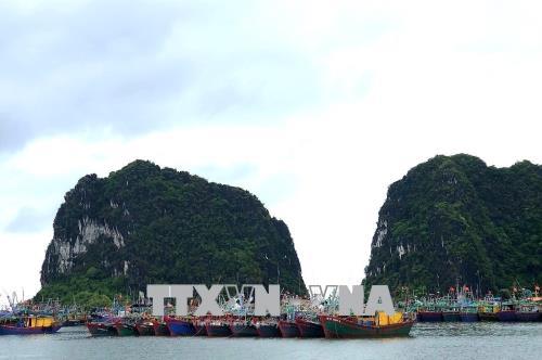
Located 30km from the mainland, Con Co island, which crosses the 17 parallel, is considered an “outpost watch” due to its location.
Covering 2.3sq.km, it is one of the most magnificent islands of the central region with a diverse ecosystem.
Located 24km from the coast of central Nghe An province, Dao Mat (
Lying 218m above sea level and covering an area of 2.2 kilometres square, Dao Mat comprises two smaller islets. From the mainland, the island look like a pair of eyes and is known as
According to defence specialists, Dao Mat has a strategic location and height, which serves as watching eyes protecting the north central coastal region.
Fifty-three years ago, on March 31, 1963, Company 32 of Division 324 set its base in Dao Mat to safeguard the country’s sea and sky. A monument has been built on the island to commemorate soldiers who died to protect the island.
Company 32 fought 297 enemy aircraft, 64 warships, 10 destroyers, one raider, two cruisers and one battleship, while rescuing 3,210 ships and 172 people.
Between 1965 and 1973, the
In 1973, the island was honoured by the Party and State with the title “Hero of Armed Forces”.
The geographical structure of the island mostly comprises rock. However, it still has diverse vegetation cover, with fig trees considered as the symbol of the island.
The island also has a 201.8m lighthouse which was built in 2004, guiding vessels operating in the area.
A flagpole was also built on the island on September 9, 2015 by Vietnamese youths.
These flag border tower and flagpoles are vivid manifestations of local people’s efforts to affirm and defend the national sovereignty.-VNA
Photo
Storm Mulan heads toward northern coast
 Storm Mulan heads toward northern coast
 Storm Mulan heads toward northern coast
 Storm Mulan heads toward northern coast